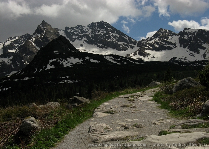
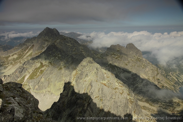
The Tatra Mountains are perfect for one-day hikes. You will find there simple routes suitable for short walks with children as well as medium and very difficult trails requiring abilities and experience. You just need to choose a route – it is good to check the maps and guidebooks or go for a trip with an experienced mountain guide. Some summits in the Polish Tatras are not available for tourists, some can be reached only by climbers. What is more – the school groups are obliged to hike only with a licensed mountain guide. When you hike in the Tatra National Park you also need to follow the marked trails – some rules are described on the Park’s website (site under construction).
EASY TRAILS
Example: The
valley floor of Dolina Koscieliska.
Very beautiful trail leads along the valley
floor of the Koscieliska Valley. It is marked in green colour. The route starts
in Kiry – a part of village Koscielisko. You can get there for example taking a
mini-bus from Zakopane (in front of the bus station) or by car (car park in
front of the entrance to the valley). It takes 1,5-2 hours to get to the mountain
hut on the Ornak clearing by the simplest way but you can also visit some side
trails (to Mrozna Cave or Krakow Gorge on the way back). Part of a trail you
can make taking a buckboard – it may be a great fun for children. After a rest
in the mountain hut there is also possibility to make a short walk to lake
Smreczynski Staw or make some more difficult trips to higher parts of the
Western Tatras. For those who feel that “it’s enough for today” – go back the
same way to Kiry.
Other examples of simple trips:
The valley floor of Dolina Chocholowska, Dolina Bialego, Dolina
Strazyska, Sciezka pod Reglami, Dolina Bystrej – to the mountain
hut on a Kondratowa clearing, Kasprowy Wierch by a cable car, Morskie
Oko
 |
| Dolina Chocholowska |
MEDIUM HARD TRAILS
Example: Kuznice
– Hala Gasienicowa - Kuznice
You can reach Kuznice (district of Zakopane) by
a mini-bus (e.g. from the bus station), by a taxi or on foot – entering the
district by your own car is forbidden. Kuznice is nowadays a headquarter of the
Tatra National Park. In the past it was the main mining center in the Polish
Tatras – you can visit there historical buildings, some are turned into
museums. From Kuznice you take a blue trail (the one which leads in eastern
direction). The trail will take you to the Hala Gasienicowa and a mountain hut “Murowaniec”
via so-called Boczan. Climbing the brow of Boczan is the only difficulty on your
way. After that you follow the rolling terrain admiring the beautiful views
around you. The way back may be a little bit diversified by taking a yellow
trail through Jaworzynka Valley and pass the old sheprds’ huts.
Other examples of medium hard trails:
Cyrhla – Wielki Kopieniec –
Dolina Olczyska – Nosal, Zazadnia – Wiktorówki – Gesia Szyja, Sarnia
Skala.
DIFFICULT TRAILS
The trails described below are mostly difficult
because they require good physical
condition.
Example: Czerwone
Wierchy
Beautiful trip, especially in the late
summer/early autumn when the plants covering that part of the mountains are
getting red. Thanks to that plants we have the name of the mountains: “Czerwone
Wierchy” simply means “Red mountains”. You start your trip in Kiry (mentioned
above) but after around 20 minutes you turn left and change the trail from
green to red one. That is a beginning of a real hiking ;) After 4 hours and
1000 meters of height difference you will reach the first summit of Czerwone
Wierchy called Ciemniak. Then you follow the main Tatra Mountains ridge to the
east through Krzesanica and Malolaczniak. On Malolaczniak you can decide to go
down (taking the blue trail with one artificial facility placed on a short
distance – a metal chain working as balustrade) or reach another summit –
Kondracka Kopa. This is a trip example for experienced hikers – it may take
8-10 hours (depending on your physical condition).
Other examples of difficult trails:
Dolina Pieciu Stawow –
Szpiglasowa Przelecz – Morskie Oko, Kasprowy Wierch – Kopa Kondracka,
Ornak – Starorobocianski – Trzydniowianski, Grzes – Rakon - Wolowiec
 |
| Western Tatras with a part of Czerwone Wierchy |
VERY DIFFICULT TRAILS
The trails described below are mostly difficult
because they require good physical
condition and they include technical difficulties.
Example: Rysy
– the highest summit in the Polish Tatras
The height difference: approx. 1600 m, trip
duration: 10-11 hours. You start the trip from Palenica Bialczanska (you can
reach it by car or by mini-bus from the bus station in Zakopane) taking the
asphalt road to the famous Morskie Oko lake and the mountain hut (2-2,30 h). It
is very popular trail so in summer there are crowds of tourists. But if you
start your trip early (6-7 AM) you will meet there only climbers, experienced
hikers or those who slept in the hut. After a short break in the shelter you
continue hiking passing two lakes – Morskie Oko and Czarny Staw and then you
climp up the summit. From the mountain hut it may take 4-4,30 hours. On your
way you will encounter some facilities like metal chains – they help crossing
steep and difficult parts of the trail. To go back you take the same trail.
If your physical conditions are very good but you’re
not sure if you manage with the technical difficulties - use the service of
reliable and experienced mountain guide. Also at other very difficult trails
like:
Orla Perc, Koscielec, Swinica.
Clothing and gear required for all the trips: backpack, trekking boots, warm waterproof clothing, raincoat, food and drink, map.
In a case of accident call +48 601 100 300 – the Mountain Rescue number.
If you need a reliable mountain guide check here.
All the hiking trials in the Tatras you will find on the maps. Tatra maps are often divided into 2 parts: Tatry Zachodnie (Western Tatras) and Tatry Wysokie (High Tatras) or Polish Tatras and Slovak Tatras. You will easly buy maps in Zakopane in almost every shop or on a street. They are also available at the entrance to the Tatra National Park.
Check also: Day hikes in the Slovak Tatra Mountains


Certainly a nice getaway for your family bonding. You pick a good place to hike and weather is so good day, really should enjoy that day.
ReplyDelete